Professional recommendations for the best surveying equipment used in construction, engineering, and land development projects across Australia.
Understanding the best surveying equipment for different applications ensures optimal project outcomes and return on investment.
Millimeter precision
The best total stations deliver millimeter-level accuracy for construction set-out, boundary surveys, and engineering projects requiring high precision.
Equipment Guide →Centimeter accuracy
Advanced GPS systems with RTK correction provide centimeter-level accuracy for large-scale mapping, topographic surveys, and infrastructure projects.
GPS Equipment →High-definition capture
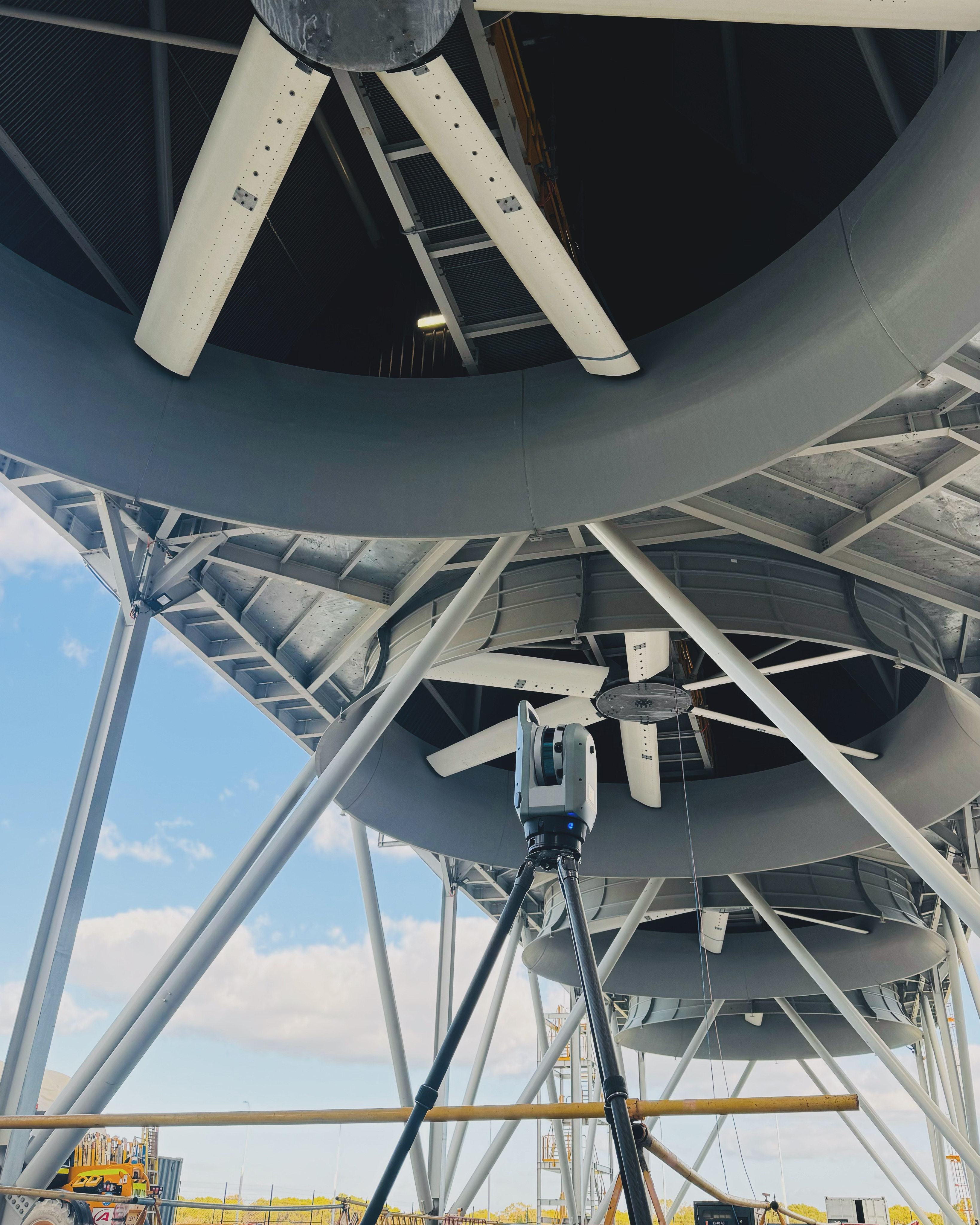
The best laser scanners capture millions of data points for as-built documentation, facility modeling, and structural monitoring applications.
Scanning Equipment →Aerial mapping
Professional drone surveying equipment delivers cost-effective aerial mapping for large areas, progress monitoring, and volumetric calculations.
Drone Equipment →Single-person operation
The best robotic total stations offer automated tracking and remote operation, increasing productivity while maintaining millimeter precision.
Robotic Systems →Traditional accuracy
Digital and auto-levels provide reliable height determination and leveling for construction, engineering, and land development applications.
Leveling Equipment →Choose the best surveying equipment based on your project requirements, accuracy needs, and operational conditions.
For construction set-out and quality control, the best equipment combination includes robotic total stations for precise positioning, GPS systems for large area coverage, and 3D laser scanners for as-built documentation.
Engineering projects require the best precision equipment including high-end total stations for design set-out, monitoring equipment for deformation analysis, and advanced scanning for detailed modeling.
For subdivision and land development, the best surveying equipment combines GPS systems for efficient coverage, total stations for boundary determination, and drone surveying for comprehensive site documentation.
Mining operations benefit from the best equipment including drone surveying for stockpile calculations, GPS systems for pit mapping, and monitoring equipment for safety and compliance.
Understanding technical specifications ensures you select the best surveying equipment for your specific project requirements.
The best surveying equipment for construction includes robotic total stations for precise set-out, GPS systems for large area coverage, and 3D laser scanners for as-built documentation. This combination provides millimeter precision, efficiency, and comprehensive project documentation.
Choose GPS equipment for large-scale mapping and areas where speed is important, achieving centimeter-level accuracy. Select total stations for millimeter-precision requirements, construction set-out, and boundary surveys. Many projects benefit from using both technologies together.
The best surveying equipment combines accuracy, reliability, ease of use, and cost-effectiveness for your specific applications. Consider factors like required precision, operating environment, project size, integration capabilities, and long-term value when selecting equipment.
Equipment hire is often cost-effective for occasional use or short-term projects, providing access to the latest technology without large capital investment. Purchase is better for regular use, with consideration of total cost of ownership, maintenance, and training requirements.
Regular calibration is essential for maintaining survey accuracy and compliance with professional standards. Professional surveyors maintain calibration schedules and quality assurance processes to ensure equipment delivers the specified accuracy throughout its operational life.
Let us bring precision to your next engineering challenge.
Get in Touch →