Our professional engineering surveying services provide precise spatial data for infrastructure, construction, and monitoring projects across Australia. Our engineering surveyors combine traditional methods with advanced technology to support the entire project lifecycle.
Experience millimeter precision and reliable results with our expert engineering surveyors and state-of-the-art technology.
Precise surveying for roads, bridges, tunnels, and other major infrastructure projects. Our engineering surveyors ensure design alignment and construction precision throughout the project lifecycle.
Comprehensive surveying services for commercial and industrial buildings, from initial site assessment through construction monitoring and final as-built documentation.
Specialized surveying for pipeline routes, utility corridors, and service infrastructure, including existing conditions mapping and design support.
Engineering surveying for mining operations, including site development, volumetric calculations, and environmental monitoring to optimize resource extraction.
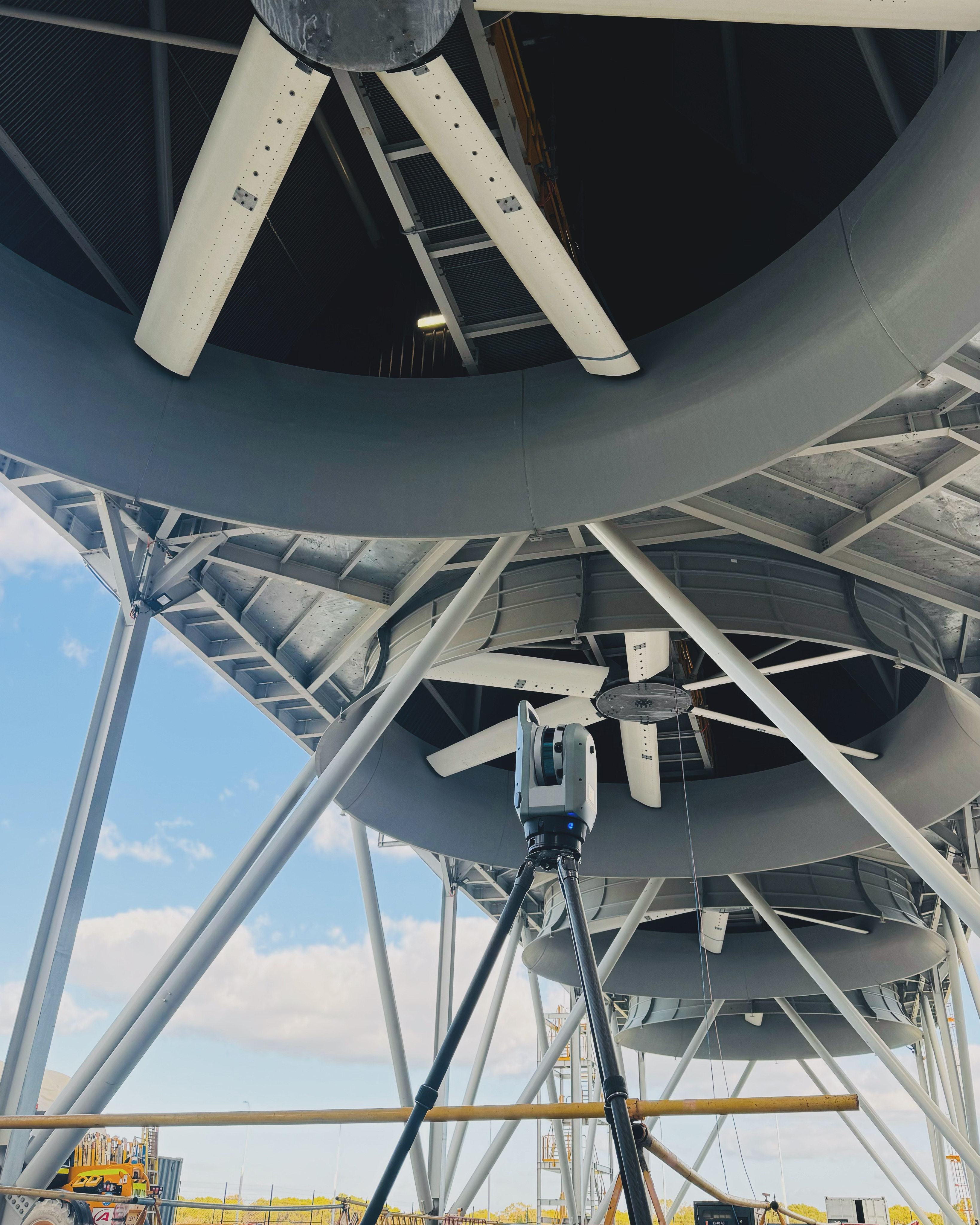
Detailed surveying for wind, solar, and hydroelectric developments, providing critical elevation data, siting optimization, and construction support.
Precision surveying for water infrastructure including dams, channels, drainage systems, and flood mitigation works to ensure proper hydraulic function.
We create detailed 3D models and digital twins of infrastructure projects using high-resolution point clouds and photogrammetry, providing valuable visualization tools for planning, construction, and asset management.
Our engineering surveyors implement precise monitoring systems to track structural movement and deformation over time, providing critical data for safety assessment and maintenance planning.
We deliver accurate material volume calculations for excavation, cut and fill operations, and stockpile management, helping optimize construction processes and control costs.
Our teams provide precise setting-out services for construction projects, ensuring that structures are built exactly according to design specifications with millimeter-level accuracy.
We establish reliable vertical control networks using differential leveling and GNSS techniques to maintain consistent elevation references across large project areas and extended timelines.
Project Planning
Detailed assessment of requirements and methodology development
Control Network
Establishment of precise control points referenced to geodetic datums
Data Collection
Comprehensive field measurements using appropriate technologies
Processing & Analysis
Rigorous data processing with quality checks and validation
Deliverable Creation
Generation of final products tailored to project requirements
Detailed plans showing topography, structures, utilities, and other features crucial for engineering design and construction planning.
Format: CAD, PDF, GIS
High-resolution 3D representations of existing conditions, structures, and terrain for engineering analysis and visualization.
Format: LAS/LAZ, RCP, OBJ, FBX
Comprehensive documentation of construction layout activities including methodology, coordinates, and quality assurance metrics.
Format: PDF, Excel
Detailed surveys of completed construction showing actual dimensions, locations, and elevations for comparison to design plans.
Format: CAD, PDF, BIM
Regular reports documenting structural movement, settlement, and deformation with statistical analysis and visualization of trends.
Format: PDF, Excel, Web Dashboard
Detailed 3D models of terrain and surfaces for design optimization, earthwork calculations, and hydraulic analysis.
Format: DTM, TIN, Contour Plans
We provide professional engineering surveying services across Australia, with specialized local expertise in the following areas:
Engineering surveying specifically focuses on providing precise spatial information for the design, construction, and monitoring of infrastructure and built assets. It requires higher precision than many other surveying disciplines and integrates closely with engineering design processes. Engineering surveyors typically work with tighter tolerances, more specialized equipment, and have expertise in construction methodologies and engineering principles.
Our engineering surveys achieve positional accuracies ranging from ±2mm for high-precision structural monitoring to ±10mm for standard construction layout work. Vertical accuracies are typically ±1-5mm depending on project requirements. We use calibrated, high-precision instruments including robotic total stations, digital levels, and RTK GNSS systems, with rigorous quality control procedures to maintain these accuracies across projects of all sizes.
Engineering surveying is essential for infrastructure projects (roads, bridges, railways, tunnels), commercial and industrial building construction, mining operations, pipeline and utility design, dam and water management systems, renewable energy facilities, and any project requiring precise spatial positioning during design and construction. It's particularly crucial for projects with strict tolerance requirements, complex geometries, or where integration with existing infrastructure is needed.
Our engineering surveying services integrate seamlessly with Building Information Modeling (BIM) by providing accurate spatial data that forms the foundation of the digital model. We deliver point clouds, 3D models, and survey data in formats compatible with major BIM platforms, allowing for clash detection, 4D scheduling, and quantity takeoffs. Our surveyors also provide field verification during construction to ensure the physical project matches the digital twin.
We employ state-of-the-art equipment including Leica and Trimble robotic total stations with sub-second accuracy, digital and automatic levels, RTK GNSS receivers, 3D laser scanners capable of collecting millions of points per second, UAVs for aerial mapping, ground penetrating radar for subsurface investigation, and specialized monitoring equipment. All instruments are regularly calibrated and certified to maintain the highest standards of accuracy.
Our quality assurance process includes instrument calibration verification, redundant measurements, closed traverses, independent checks of critical positions, statistical analysis of results, and comprehensive documentation of methodologies. We maintain detailed records of control networks and implement rigorous procedures to ensure consistency across multiple survey sessions and different team members. Our work is supervised by licensed surveyors with specific expertise in engineering applications.
Contact our team for a consultation and discover how our engineering surveying expertise can provide the precision and reliability your project requires.